
4th of July Weekend 2005: Jenny (my ex-gf) and I went to Lake Tahoe to stay with her friends Amanda and Jeff. While there, I noticed an ancient guidebook sitting on one of their tables for the Tahoe-Yosemite trail. Thumbing through it, I quickly became interested in a long distance hike. Jenny is a very outdoorsy sort of girl, and at her encouragement, I had purchased a mountain bike. As I read the book, I thought back to my days of backpacking and camping in the Boy Scouts, in particular reminiscing over high adventure backpacking trips I completed in the mountains of Virginia at High Knoll and New Mexico at Philmont Scout Ranch.
July-Sept: After I returned from my trip to Lake Tahoe, I googled the Tahoe Yosemite trail and discovered an online account of the journey that David Cobb and Steve Queen accomplished. Intrigued by the well-written account and beautiful photos, my interest grew. Sometime during this period, I wrote Clay and asked him if he would be interested in a long distance backpacking trip. At the time, Clay was traveling in his “grease-truck”, a diesel truck that runs on vegetable oil which he built after he got out of the Marines. Clay was using the truck to travel across the country and also trailbuilding in the Alpine Lakes wilderness in Washington State. Clay responded that he would definitely be interested in a long hike, and I began the planning process.
To physically prepare myself, I accomplished two day hikes and an overnight camping trip. Needless to say, when the actual time came for us to do the hike, I was physically unprepared. I also dropped an incredibly stupid amount of coin at REI, which had now become my favorite shopping vice. To give you some idea of the kind of excess I went to, I even purchased a titanium spork.
I ordered a copy of the guidebook I had seen at Jeff and Amanda’s place from Amazon.com. With only two copies in stock and both used, I placed an order for one for $27.99. You can imagine my shock when the 33 year old guidebook arrived with 2.95 stamped on the front cover. Oh well.. Using the Cobb/Queen website story, the guidebook, and a website called topozone.com, I generated 140 GPS waypoints for our journey. (More to follow on use of the GPS later.) My friend Chuck used Google Earth to generate a 3-D map of the trip. Needless to say I was getting excited.
Clay and I coordinated for him to arrive on the 17th. He was going to do a bit more traveling after his crew finished their job in the Alpine Lakes wilderness. I wasn’t too worried when I didn’t hear from Clay for a week or two because I knew Clay would have infrequent computer access.
Sept 16: I hadn’t heard from Clay in three weeks so I called his mom, who likewise had not heard from him. She and I both were getting worried since Clay was supposed to arrive by the 17th. Around 11 PM I get a call from Clay saying that he was at the corner of Craig Road and I-15 in Las Vegas. I gave him directions to the house and he arrived successfully. We wound up staying up and chatting until about 2 AM.
Sept 17: I went to work at 0630 and returned home at 3 PM. Clay and I headed for the Smiths grocery store. $185 later, we decided we had enough food and went to my favorite Mediterranean café, run by my friend Jordan. After gorging ourselves on gyros, we drove across town to REI for some last minute items. I decided to buy a bit more food (freeze dried stuff) also.
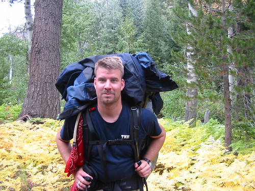
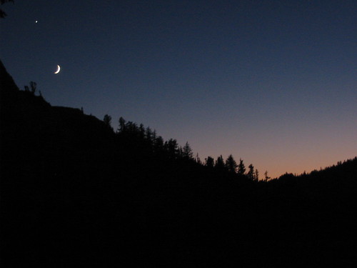
Sept 18: Clay and I spent all morning dividing the food between our initial food and 3 food drops. We finally left home around 1 PM, stopping to get motor oil for his grease truck at Wal-Mart. We stopped by Indian Springs (Creech AFB) where I gave Clay a tour of Predator-town and my co-workers a tour of Clay’s truck. Clay and I grabbed some Chester’s “Diesel Fried Chicken” and hit the road again. At a pleasant crawl of 60-65 MPH (speed limit of 75) on the flat areas, we finally reached the turnoff from Hwy 95 (which happens to coincide with the “Shady Lady Brothel.” I pulled over on the side of the road, check the map, and Clay and I chuckled from the side of the road at the brothel, which is little more than a couple of RV campers and some plywood. We turned left and began to head down what is probably the poorest quality paved state highway in Nevada. I noticed that I was rapidly pulling away from Clay while driving at 60 MPH (speed limit here was 65 MPH) so I slowed to a crawl. We proceeded through the backroad at an obscenely slow pace, but were treated with beautiful scenery, a five mile stretch of highway where cows freely cross back and forth (no fence) and a phenomenal moonrise. I finally had to refill on gas and Clay and I got burgers. We asked a local ranger who was in the restaurant portion of the gas station where he recommended we camp and he offered some advice. Cla and I continued on our journey towards Yosemite but decided to turn off on a side dirt road and sleep for a bit. We tossed our sleeping bags and foam pads on top of his truck and camped out up there. I think it wound up getting down to the upper 20s that night as we both wound up with a bit of frost covering our sleeping bags.
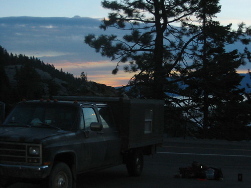
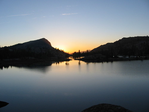
Sep 19: Clay and I continued the drive to Yosemite, with me making a quick detour in Lee Irvine town to hit a store to get my fishing license. Clay and I met up at the Toulumne Meadows trailhead then we drove back up to the ranger station to drop a vehicle off. At the ranger station, we met the lovely park ranger Caroline, who Clay would continue to talk about the entire trip. Clay and I secured my car and departed northbound in the grease truck. While driving northbound, we decided to drop our food off rather than try and mail it out. BIG MISTAKE! Two hours later of uphill twisty roads, with the grease truck wheezing and growling the whole way, we reached the Kennedy Meadow store (only 20 miles traveled over those two hours). At that point and after discussion with the nice lady at the Kennedy Meadow store, we decided to head to the UPS store in Sonora and mail the other two packages out. We sent the Lake Alpine Lodge package via UPS and the Echo Lake package via US Postal Service. (ANOTHER BIG MISTAKE!!!) After dropping the packages in the mail, Clay ordered a pizza from a take-and-bake chain called “Papa Murphy’s” only to realize that a take-and-bake pizza is uncooked. We wound up getting supper from a grocery store and drove the 3 hours to Tahoe. Upon arriving in South tahoe we hit a gas station to top off water bottles and buy lip balm. A California Highway Patorl officer suggested that we park at Eagle Falls for the duration of our trip. We spent the night in the Eagle Falls parking lot, with Clay sleeping on top of the truck and me sleeping in the camper.
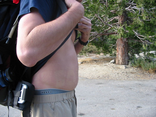
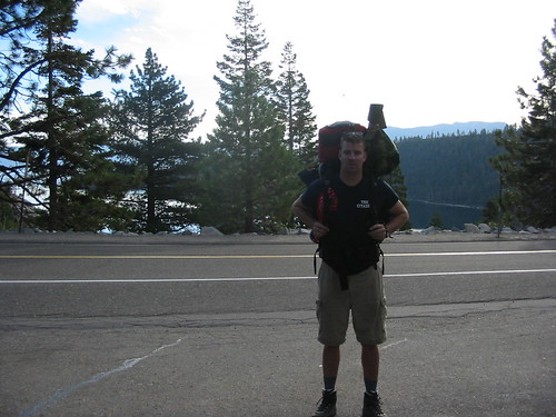
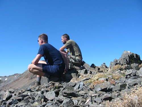
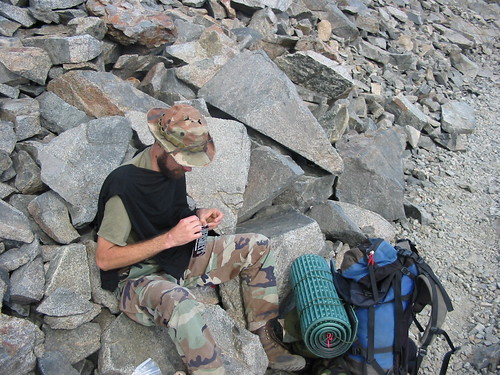
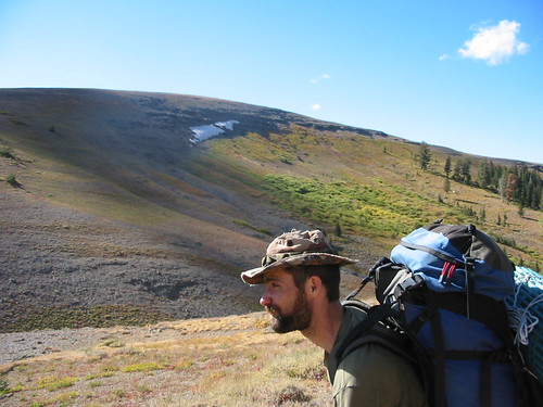
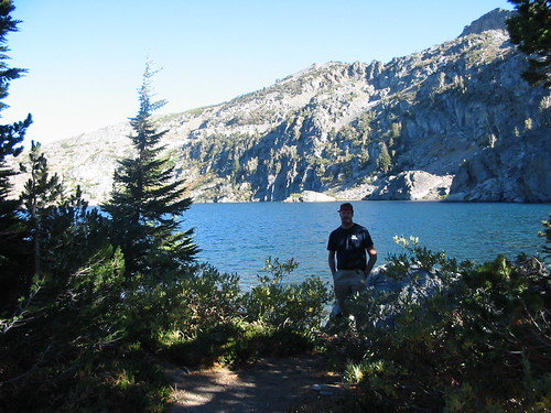
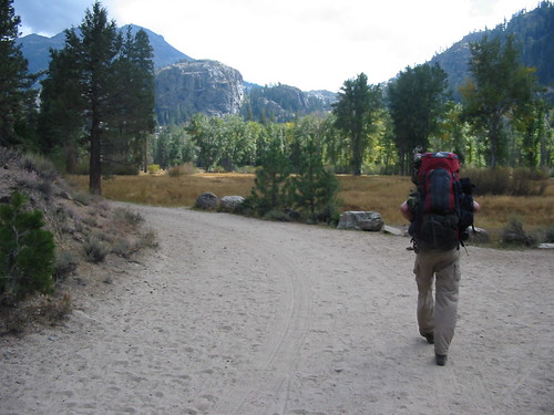
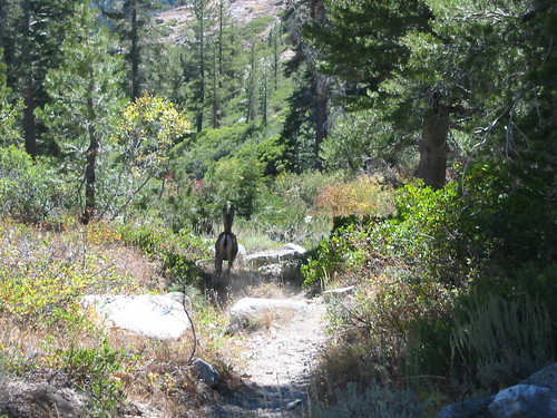
Sep 20 DAY ONE: … And we’re off! After catching a couple snapshots of Clay snoozing, a hot air balloon, and my pudgy belly, Clay and I hit the trail. One mile of uphill later, we stopped for a snack and I wondered if I had brought my car keys (which would be needed to drive my car back from Yosemite.) Nope!! Clay and I dropped our packs and headed back to the truck. We grabbed the keys, returned to our packs, and continued our uphill climb, passing Eagle Lake. Finally we reached the crest of a hill where a sign pointed to Dick’s Lake. Down we went and we set up camp right where the lake fed a small creek. I pitched my tent and Clay set up his poncho shelter nearby. I fished for about an hour with no luck, then moseyed around the lake where I met up with brothers John and Steve, two rednecks from the Tahoe area.
After chatting with them pleasantly for about an hour I walked the 100 yards back to our camp to find Clay cooking a delicious batch of Zataran’s Jambalaya. With the addition of onions, garlic, and chopped summer sausage, Clay convinced me to eat far more than I should have. (EDIT) Zataran's story removed to make it "parent-friendly." NOTE: To this day, I’m no longer able to eat Zataran’s.
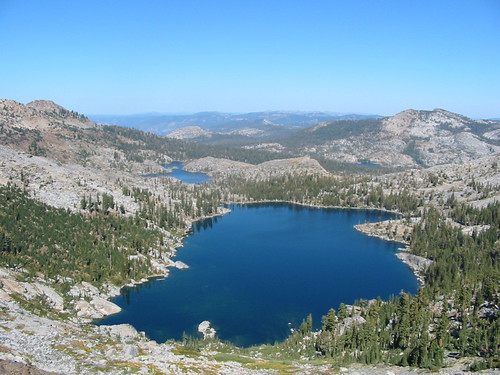
Sep 21 DAY TWO: Dawn arrived and we broke camp quickly after a breakfast of grits with bacon I had cooked three days prior and sealed in a Ziploc bag. We hiked up the hill to Dick’s Pass where we relieved a spectacular view of Lake Aloha and Dick’s Lake. The rugged rocky “moonscape” of Desolation wilderness is incredible and unlike any place we had ever hiked before. We trekked down, pausing briefly at Gilmore Lake to soak our feet. Continuing onward, we passed Susie Lake and paused at another Lake to have lunch. Cheddar, summer sausage, and an apple became a reappearing staple of our lunch menu. A passerby suggested an excellent campsite located midway down Lake Aloha.
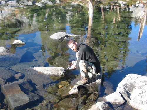
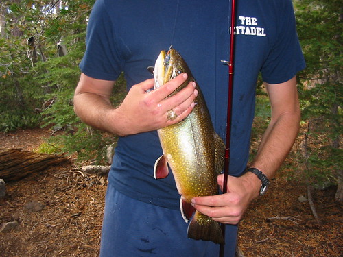
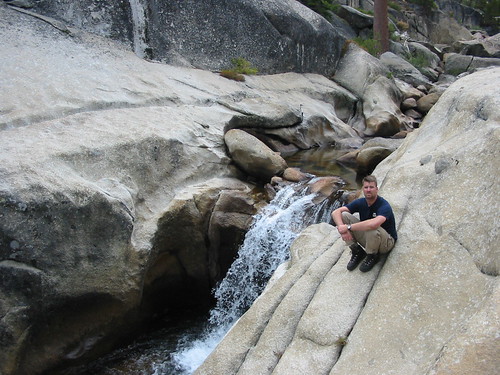
Sure enough, we found the campsite to be superb. After setting camp, Clay took a nap and I hurried down to the lake to fish. On my fifth or sixth cast, I landed a stunning fat trout approximate 16-18 inches long and pushing 2-2.5 lbs. After Clay took a picture I released the trout who swam off. (We had too much food in our packs at this point). Dinner consisted of instant rice with canned chicken and an onion and mushroom gravy packet. DELICIOUS!!!
Sept 22 DAY THREE: I broke camp quickly before Clay and set out 20-30 minutes ahead of him, fully expecting him to catch me. I passed two or three side trails, all leading to Lake of the Woods, then I encountered a brutal series of rocky, downhill switchbacks. After descending down the switchbacks which overlooked Tamarack Lake, I trekked onwards, and soon came to a sign for the Echo Lake Water taxi. I descended to find no one there, but did spot a boat at the dock, ready to go. I sighed and hiked the 3 miles to a bluff overlooking S. Tahoe and Lake Tahoe on one side, and Lake Echo on the other. I moseyed down to the Echo Lake Lodge only to find it and the post office where our resupply was due at to be closed. Clay arrived at the lodge about 15 minutes after I did and managed to find someone who worked there. Apparently they were “winterizing” and the mail was due in an hour. Brian, the lodge guy, said to be on the lookout for an old guy named “John” driving a brown car. John showed up after an hour, but no package. Clay and I hiked the 100 yards up from the lodge and broke out our mattress pads on a bluff overlooking Lake Tahoe. Now worried about our food supply, which had been fat only 18 hours before, we wound up eating cheese, sausage, and crackers for supper since we’d also run out of canister fuel the night prior. Our spot was a really cool place to camp which makes me wonder why they placed a “no camping” sign there.
Sep 23 DAY 4: Since Clay and I decided the day prior to wait and see if our package would come in the mail today, we hung around the outside of the lodge all morning until John finally arrived at noon in his late 70s Honda hatchback with the mail. STILL NO PACKAGE!!! We decided to hike up to Hwy 60 where Clay unsuccessfully hitchhiked the 5 miles and back to and from the nearest gas station. When he returned, we divided up the food only to discover that a third of it had fallen through holes in the plastic bag. Angry as hell, we took off south towards Showers Lake, which we estimated as approximately 10 miles away. So, to set the scene.. it was 4 PM and we were setting out for a 10 mile leg, of which the first four miles were solid uphill with a significant eleveation gain. About halfway up, I told Clay to go on ahead of me. NOT SMART!!! By the time I finished the hill, I was running low on water, dark was approaching and Clay was nowhere to be seen. I trudged onward, finding a sign indicating 5 miles to Showers Lake. I almost cried. The sun set approximately 10 minutes after I passed the sign. By this time, I’m angry as hell at Clay for getting us this separated, even through I knew I had told him to go on ahead of me.
Approximately 30 minutes after sunset, I put on a long sleeve shirt and my headlamp. I probably hiked 1.5 hours before I ran across an ultralight PCT (Pacific Crest Trail) hiker who I had met earlier in the day. He recognized Clay’s bootprints and suggested that Clay might be camped next to the lake. I hiked onward, tired and thirsty and followed what I thought was the trail onto some rocks. I clambored down the rocks where the trail appeared to go approximately 150 yards before I decided I had definitely lost the trail. At that point I was exhausted and dehydrated since I had long since run out of water. I decided to camp on a semi-flat spot rather than attempt to crawl back up in the dark. After a few minutes in my sleeping bag, I realized I was going to be in bad shape come morning from dehydration. I bundled up in my clothes, repacked my bag, and set out to climb back up. Every 5 or 6 steps I had to pause, out of breath from dehydration, even though I could hear a creek 20 yards to my right. Finally I decided to risk giardia and dipped my Nalgene bottle in the creek for a drink. Refreshed after drinking half a bottle of unfiltered water, I began my climb anew. I easily returned to the trail and passed a noisy crowd at a campsite, with a female voice calling out “Are you the Air Force guy?” I responded “yes” and Clay pipes up “Songer!” I walk to the campfire and very quietly said “We need to talk Clay”. We headed to his campsite for supper, consisting of chicken and rice. I calmly discussed that we really needed to work as a team (though I will admit when I was dehydrated and stuck in the crevice I thought very seriously about attempting to inflict bodily harm upon my good buddy Clayfus for abandoning me completely). In hindsight, I think I was as scared when I recognized my dehydration down in that canyon as I was during a mortar attack I’d been on the receiving end of in Iraq the August prior.
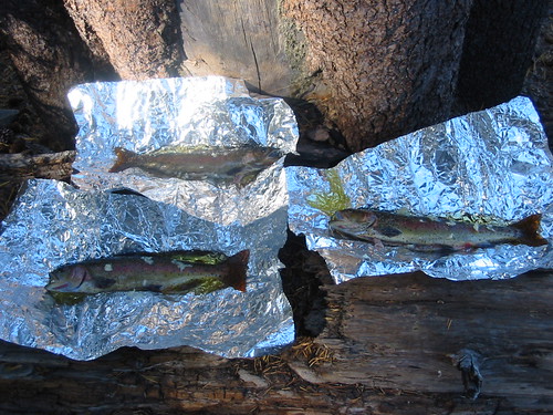
Sep 24 DAY 5: I was up at the crack of dawn, and watched an incredible sunrise from Showers Lake. I decided to do some fishing and before Clay was even out of his bag, I’d caught three trout. I brought them back to Clay, who cleaned them, put them in aluminum foil with garlic, olive oil, salt, and pepper, and placed them on the fire. I think those fish were probably the best meal of the entire trip. We also had the rest of the grits I had left.
We broke camp late and had an extremely pleasant hike down a shaded valley, past the upper Truckee river (really a creek at this point), through a beautiful meadow with an old abandoned farmhouse, and over some hills on the way to Carson Pass. We stopped for lunch and chatted with a California D.N.R guy who was accompanied by a lovely Airedale. He mentioned that he was looking for hunters to make sure they were in compliance with California game laws. At this point, Clay and I realized we were hiking during deer season.
We continued down the trail to Carson Pass on Hwy 88 and stopped in at the Visitor’s Center. After chatting with Bob and Carol, the rangers at the visitor’s center, we realized we didn’t have close to enough food for our next leg. Carol gave us a can of beef stew and some carrots she kept in her car. Bob suggested we hike the two miles to Woods Lake campground. We did so and met the campground manager Mary who suggested we just sleep out somewhere. We hiked about 200 yards and stopped at a campsite where3 some Hispanic hunters were having supper. We asked to cook our can of stew over their fire and they fave each of us a piece of chicken and a Coke. Mmmmmmmm… Canned stew, fried chicken, and soda! By this point we were so hungry that we didn’t care what we ate. We decided to hike back to the pass and either try to beg Jenny’s friends to bring us food or hitchhike into town the next morning for more food.
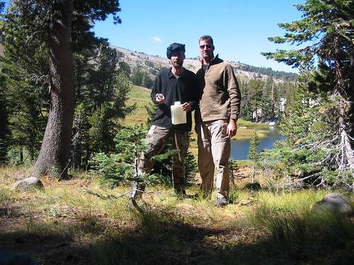
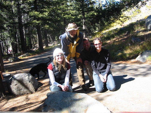
Sep 25 DAY 6: We hiked the 2 miles back to the Carson Pass Visitor’s Center and I called my parents collect, who in turn called my girlfriend Jenny. Jenny called Chrstina, her supersweet friend who lived in Tahoe and a few hours later, Christina and Josie arrived with canister food and fuel. What a pair of angels! I actually got a little choked up on the phone talking to them when they said they'd bring us some food.
While waiting for the food, we met Billy from N. Carolina who was doing some hiking while on his way to San Francisco to find a job. He agreed to meet up with us to camp at Fourth of July Lake. We also spent several hours discussing the route we intended to take. We decided to continue with the trail outlined in the guidebook, even though it was no longer maintained by the US Forest Service. (GOOD DECISION!)
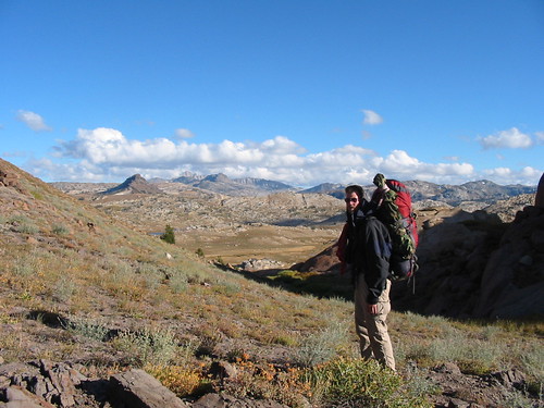
The girls arrived and gave us rides back to our packs at Woods Lake campground. We packed the food and fuel they brought us, took a picture with them and got big sloppy dog kisses from Christina’s beautiful black lab. Clay and I set back out on the trail, resupplied, fed, and re-energized for our trip. We climbed the trail past Lake Winnemucca and Lake Roundtop, pausing to play in some snow still on the mountain, then we began a steep descent down to Fourth of July Lake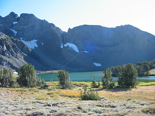 .
.
What a great campsite! We met up with Billy and I caught and released a couple of small trout then we went to bed. Shortly before midnight I awoke to a mini-bear of some kind crawling across my ski-mask covered head. I yelled and swatted it off then went back to sleep.
Sep 26 DAY 7: We awoke to a cloud-covered sky. With a forecast from the previous day calling for rain and thunderstorms, we broke camp early, saying our goodbyes to Billy. After a few minutes of difficulty finding the trail down to Summit City Canyon, Clay decided we should bushwack down the mountain. About a third of the way down, the rain began. By the time we were halfway down, I was cursing Clay and angry as hell. There we were on an extremely steep descent, bushwacking through prickly bushes, getting rained on as we tried not to slip on slick rocks. Definitely not what I’d call either a safe or pleasant climb down the mountain.
When we reached the bottom, I threw out some Air Force Flight Safety School jargon and attempted to impress upon Clay the need for good “Operational Risk Management.” We took off down the Summit City Canyon trail and discovered some incredible scenery. In vast contrast to the rockscape of the canyon walls, the canyon itself was a near-wetlands plethora of flora. Bright green ferns and dense canopies of pine, fir, and cedar made for one of the best hikes of our entire trip.
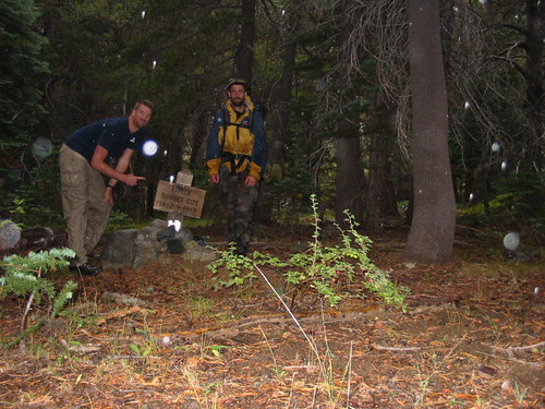
After passing a pair of brothers on their way out, we didn’t see another person until we were one mile from reaching Lake Alpine two and a half days later. The trail continued down the canyon with a fair number of “blowdowns” forcing us to deviate and reacquire the trail. We passed a sign for “Lower Summit City 1862-1867” and continued down the heavily forested canyon.
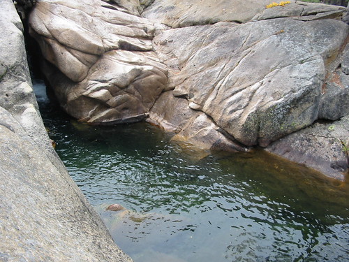
Eventually the forest began to thin out and we found ourselves scrambling over massive boulders and following rock cairns which indicated the trail. We discovered an exceptional serious of pools, miniature waterfalls, and rock bowls along the stream. The ranger at the Carson Pass Visitor’s Center had attempted to dissuade us from this route, but I’m really glad we took it as I consider it the best stretch of the entire trip.
We continued down the canyon, following the trail and river until we came to an excellent campsite on a bluff overlooking the Mokelumne River valley. As evening approached, we set up camp and received a lovely lightning show and rainstorm with a small amount of pea-sized hail.

Sep 27 DAY 8: Dawn arrived with some light morning showers, finally tapering off around 8 AM. As the sun tried to poke its head out, we packed up and continued down the rocky trail before entering a dense pine canopy. Some of these Ponderosa pines in the lowlands of the Mokelumne River valley have diameters approaching 10 feet. The trail at this point became somewhat difficult to follow, but continuing in the same direction returned us to the trail where it climbed 300 or more feet above the valley floor. The trail eventually returned to another dense pine forest. Within this pine forest we again lost the trail. While we didn’t try it, I doubt we’d have even gotten good GPS reception in that deep valley underneath the dense pine canopy. Occasionally we’d also happen upon sugarcone pine trees, their enormous cones occasionally exceeding 18 inches in length and upwards of two pounds in weight. Certainly not something I’d want to be under when they fell!
Continuing in the direction the now disappeared trail appeared to follow brought us to the banks of the Mokelumne. We found a shallow place (10 inches deep) and forded across, arriving smack in the middle of Camp Irene. The only features of Camp Irene (other than actually being located on a map and called “Camp Irene”) are three fire rings, each approximately 100 yards apart. We chose the easternmost, which is underneath dense canopy with a minor creek trickling down to the Mokelumne. The westernmost fire ring sits on a 50’ bluff overlooking the river. I managed to wet a line and fished for an hour or two unsuccessfully.
Sep 28 DAY 9: We awoke early and set out on the climb up from Camp Irene. After 3.5 grueling hours of uphill, we reached a minor peak shortly after noon and lunched there. Then after 20 minutes more of uphill hiking, we crested the hill and exited the Mokelumne Wilderness boundary. We reached Hwy 4 approximately one hour later and hiked the two miles to the Lake Alpine Lodge in order to pick up our food resupply. I called my parents and then decided to get a cabin and do laundry. Clay decided to hike down to Duck Lake and camp there. One hour of hot shower later, with a clean load of clothes, I felt refreshed. I slept like a baby that night in the cabin, though Clay scorned the idea of a good night’s rest off the trail. Oh well, that’s why I joined the Air Force and he joined the Marines!
Sep 29 DAY 10: I left the cabin at approximately 0830 and hiked to the trailhead. From there I hiked the 2.5 or so miles to the junction of the trail and Duck Lake. I left another note for Clay but he caught up to me after approximately 30 minutes. Mostly a fairly uneventful day, we got some excellent views of the Dardannelles and discovered a new reservoir not shown in the map of my 35 year old trail guide. We camped 100 yards to the right of the trail at a decent campsite approximately ½ mile prior to the Jenkins Canyon Junction.
Sep 30 DAY 11: We set out early and made good time on the rather moderate up-and-down hill portions. Eventually we arrived at the Arnot Bridge campground. We hiked up a paved road to Iceberg Meadow then returned to the trail. From Iceberg Meadow, we hiked approximately half the distance to Boulder Creek and camped along the north side of the creek. Just prior to arriving at the creek, we met two nice fellows who suggested we take the Seven Pines trail instead of trying to crest at St Mary’s Pass. They also gave us a nice map of the area since they were finished with it. I have to admit, I was really surprised at the overwhelming generosity of folks along the entire trip.
Oct 1 DAY 12: We hiked up to the Jenkins Canyon trail and followed it a mile or two before arriving at a sign for the Seven Pines trail. We followed the trail uphill easily for about 3 miles then paused for lunch where the trail seemed to disappear. Confident that the trail continued up the hill, we bushwacked up the ridge only to find the trail nonexistent. We worked eastward along the ridgeline until Clay employed his exceptional map skills and determined where the trail should be. I was a bit worried and insisted we use the GPS, and sure enough, we were exactly where Clay said we should be. We crested the hill after a climb through a nasty rubble field then trekked down the ridge on the far side. Clay relocated the trail which disappeared twice more during our descent. Eventually the trail solidified after we did a significant amount of bushwacking down the steep slope. We followed the trail to a decent lookout point and were able to see cars on Hwy 108. At this point the trailed turned into an obscenely steep downhill trek through silty, fine powder. Under NO circumstances would I have attempted that trail in the other direction. We did see a great deal of horse tracks where folks had led horses up the trail. Eventually we ran into the highway and met a nice fellow who was packing up from fly fishing. He gave us a ride to the Kennedy Meadows store, 3 miles away.
We arrived at the store and the clerk recognized us. I insisted that we eat in the store restaurant, and eventually Clay caved and agreed, since I offered to treat. The meal was excellent, just absolutely delicious roast beef and the prices were extremely reasonable. We grabbed our packs and hiked back down to find a place to camp. Clay grabbed a spot 15 yards behind a “No Camping Here” sign. Fearing rain, I continued onward and proceeded to camp in an actual campsite at the north trailhead. (I think I had to pay $5 for it.)
Oct 2 DAY 13: I woke Clay up early to keep him from getting caught poaching his sleeping spot behind the “No Camping Here” sign. We rested a good chunk of the morning in addition to picking up our food and paying the campground manager the $5 fee for my campsite.
We set out after a Rice-A-Roni and summer sausage lunch at approximately 1 PM. The hike through Kennedy Meadow was pleasant though we saw no sign of the movie set from “Mail Order Bride” which our 35 year old guidebook discussed and insisted was there.
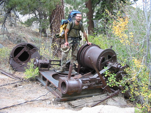
The trail beyond the eastern trailhead is extraordinarily well built. We paused and chatted with two nice gentlemen who both stated they wished they were 30 years younger and going with us. We discovered an old steam “mule” engine over which Clay salivated and took about 20 pictures.
We pressed on up the climb, anxious to get to Grove Creek as we could see storm clouds rolling in on the far side of the lake.We spooked some deer at Grove Creek and set up camp just in time to get a few drops of rain, the only rain of the evening.
Oct 3 DAY 14: We broke camp around ten-ish which became a trend in the days to follow. The trail follows Summit Creek up past what we assumed is the sheep ranch as denoted on our guidebook map. Clay and I had planned on stopping at Lunch Meadow to camp but we had made good time and decided to press on up Brown Bear Pass. We paused at Brown Bear Pass for a photo opportunity but the dropping temperature and fast-falling sun drove us down into Emigrant Meadow.As we descended down the pass, we found it easy to imagine herds of buffalo or trains of wagons crossing this beautiful expanse.
 We camped in the rocks just north of Emigrant Lake for what turned out to be the coldest night of the trip. I woke up several times to find the interior of my tent frosted over with condensation from my body and breathing. Clay said he woke up once and found his entire Bivy sack iced up. The temperatures definitely reached a dangerous point during the night.
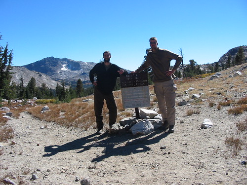
Oct 4 DAY 15: As daylight broke, we discovered the smaller ponds and a significant chunk of Emigrant Lake were now covered in a sheet of ice approximately ¼” thick. We packed up and hiked up past Grizzly Meadow, eventually pausing for a “tuna and crackers” lunch in Summit Meadow. We pressed up to Bond Pass and there we finally entered the Yosemite Wilderness.
We hiked down Jack Main Canyon, pausing to chat with a nice Belgian couple. We stopped to camp along the creek approximately 1 mile prior to the trail junction for Tilden Creek.
Oct 5 DAY 16: We broke camp ealy and decided to remain on the PCT, bypassing Tilden Lake. Unfortunately, while we were breaking camp, I had to take care of “personal business” and accidentally mooned the Belgians who just happened to be walking by while I had my pants dropped for necessary reasons. Not my finest hour… the last thing they needed to be welcomed to the States with was some random hiker blasting horrid flatulence in their direction with his pants around his ankles. We hiked past another lake, marveling at the trout we saw swimming near the shoreline. All in all, a mostly uneventful day. By this point, I was really beginning to reach my stride. While Clay could still certainly outpace me, I was no longer struggling with 6-7 miles per day and I think we cleared 11.8 this day. Eventually we reached a nice campsite with fire rings on the far side of a creek.
Oct 6 DAY 17: I must go ahead and ask forgiveness as somewhere around this point I stopped taking notes and am accomplishing the remainder solely off my poor recollection. We continued over a couple more ridgelines, our route really traveling perpendicular to the ridgelines. I can’t remember the name of the rocky area, but even the name was forbidding. Definitely a rough day, we still managed to make 11 or so miles despite the rough up and downs through the rocky terrain. We eventually climbed out and reached Smedberg Lake. Not really seeing a good place to camp, and not wanting to camp in the middle of the meadow, we climbed on rocks around the lake, eventually finding a great rock with a flat area about 15x20 feet that hung out over the lake.
From that rock I was able to fish and caught 6 beautiful little rainbow trout. We released them and cooked ourselves a nice meal on our rock patio with some of the REI freeze dried food.

Interestingly enough, as we were hanging our bear bag, we noticed we’d hung it directly over some bear feces. Talk about a good reminder of the need to hang a bear bag!!!
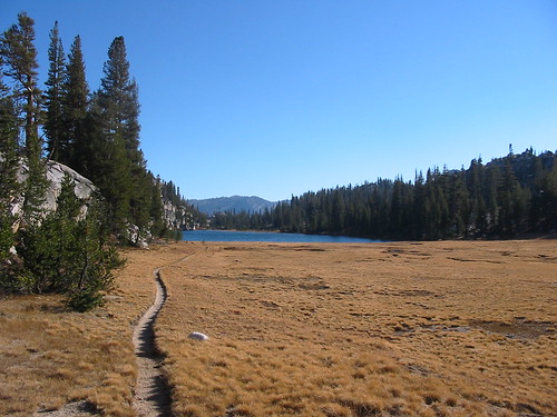
Oct 7 DAY 18: We got up early and headed for Toulumne Meadows at full bore. Most of the hike at this point was downhill, with us tearing through the massive meadows on the home stretch. We really hit our stride on this final day, blowing out a massive 15.8 miles overall. We trekked down the valley, eventually reaching Glen Aulin campsite. 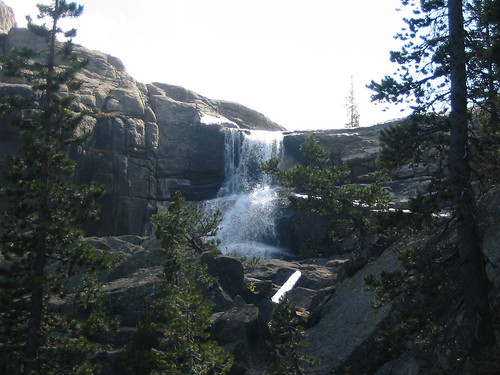 We took a couple pictures of the waterfall, then continued onward. At this point, the trail really turned a bit mickey-mouse. We backpacked past quite a few young kids out for day hikes, several school or church groups, and even happened upon a blind couple who were negotiating the trail with the help of a seeing-eye dog. We were thoroughly impressed with their ability to maintain the trail and know where they were going. Following the contours of Toulumne River. I saw quite a few beautiful trout, some quite significant in size hiding in the eddies of the river.
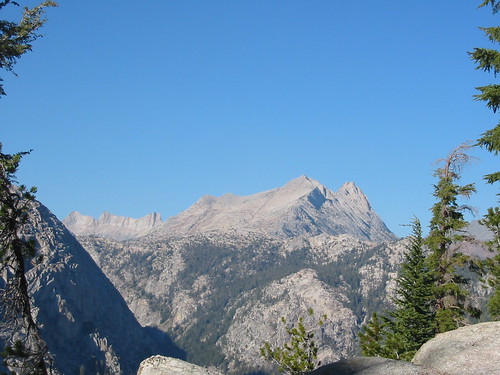
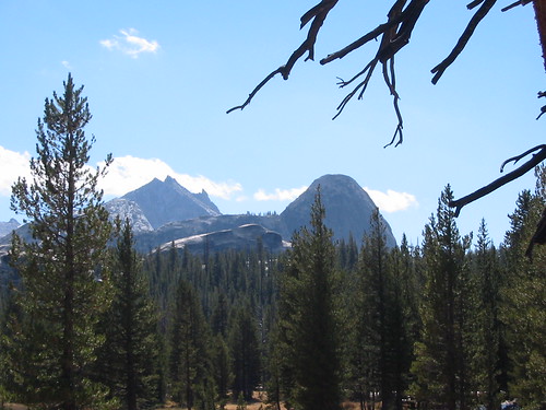
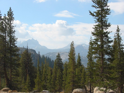
Eventually we came upon the massive rock face near Toulumne Meadows and gazed at the skyline of incredible peaks and hills of Yosemite. Toulumne Meadows definitely had one of the best skylines of the trip.
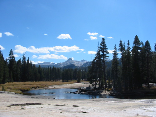
Near the end of our hike, we reached the actual meadows. There’s actually a soda spring about a half mile from the highway, surrounded by a little log cabin. We stopped and took a drink of the evervescent and bubbly soda water, delighting in its coolness and the slightly salty carbonation. Definitely one of the coolest works of nature we saw on our trip! We continued to the highway and hiked the half-mile to the ranger station. Clay was disappointed not to see Caroline at the end of the journey, though he’d talked about her most of the trip. We did however see the girl we had dubbed “Skunk Stripe” because of the single blonde streak she had in her hair. After showing the rangers our pictures of the journey, we discovered that we were actually allowed to have fires in a good chunk of the park, much to our chagrin.

We hopped in the Sentra and drove back to Tahoe, camping out another night on Clay’s truck. We both woke up around 3 AM and were ready to finish the drive back home, but Clay’s truck wouldn’t start. We said screw it and went to Denny’s where Clay finished two entire Denny’s Specials. (THAT’S A LOT OF FOOD!!!) We went back to the truck as day broke and discovered that all of his glow plugs were fouled and misshapen. We drove back into town as AutoZone opened and Clay purchased enough plugs to replace his fouled plugs. The truck promptly started and we began the long slow trip back home, with Clay averaging about 60-65 MPH in the 75 MPH zone. I kept pace with him in the Sentra and was pleasantly surprised to notice almost a 20% increase in fuel economy from driving at that speed. Since that time, I’ve mostly been driving much slower in order to get better fuel economy.
We finally pulled into the house and I hopped in the shower for 30 minutes of good, hot cleansing. The next day, Clay and I went to Sushi on Summerlin where we put 15 suishi rolls plus icecream away. All in all, a fitting end to a great trip. I lost almost 19 pounds on the trip. For the next week or so, I had difficulty wearing boots due to the tremendous strains I’d placed on my ankes and tendons during the journey. Still, it was well worth it! For anyone interested in hiking that trail, I say go for it!
3 comments:
John,
I'm going to read this in portions..wow, what a trip you had! I look at all the pictures and read around them. I'm so impressed. I've always wanted to do something like this. Todd and I have talked about learning canyoneering and such. I think you've inspired me to go for it.
I didn't know you had a blog. I'm very impressed. We blog owners are a breed apart!
Love you,
Lisa
Scorrn! (Rubio here)
Awesome story, absolutely amazing pictures, and what a great experience it must have been!
It makes me want to strap on the backpack and follow in your footsteps!
Do you have the GPS waypoints available?
Thanks
JD
Post a Comment